

Detection and Mapping of Utilities (pipes, cables), rebar and voids. Pre-studies for Horizontal Directional Drilling (HDD), Roadways and railroad tracks, bridge deck and bridge foundation studies.
Hazardous waste mapping, underground storage tanks (UST), Sedimentology studies.
Stratigraphic mapping, cavities and sinkholes, groundwater, mining hazards, fracture detection, earth dam studies, foundation studies, tunnel investigations.
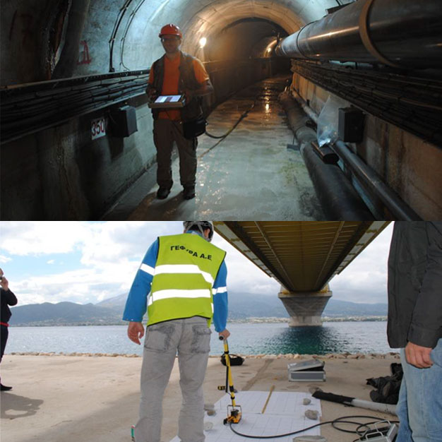
Terra-Marine is a consulting geologist firm specializing in Environmental & Geotechnical applications that has been involved in large scale projects
Terra Marine is, also, official distributor of Guideline Geo and Geotomographie GmbH for the territory of Greece and Cyprus.
More about us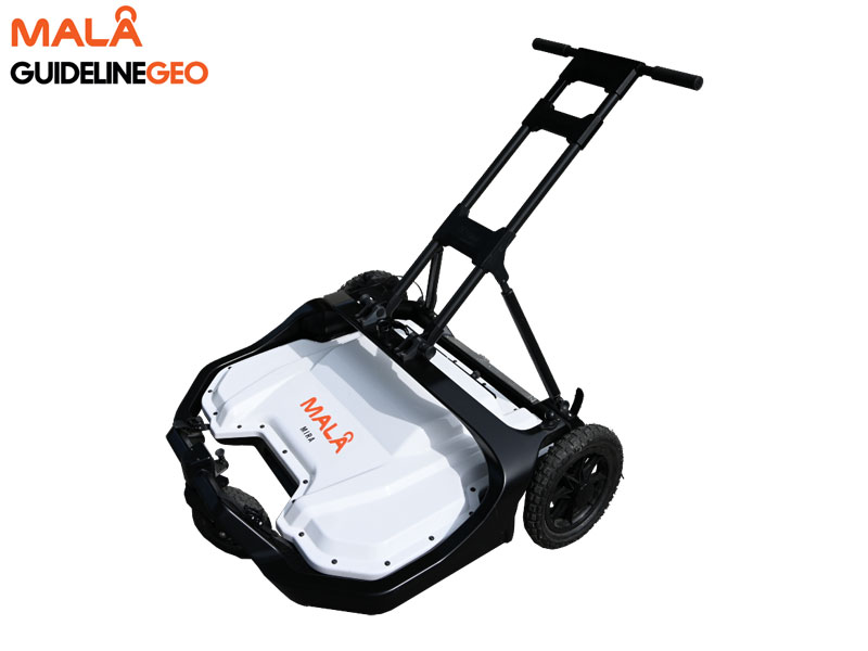
MALÅ 3D Imaging Radar Array (MIRA) is a high-speed, one-pass 3D GPR system and the most effective solution for large-area GPR mapping.
MIRA Compact includes the world-renowned MALÅ HDR real-time sampling technology providing ultra-fast measurements and razor sharp data. The solution seamlessly integrates acquisition, processing, QA/QC, positioning and interpretation of ground penetrating radar data.
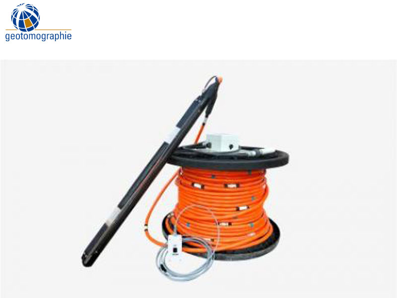
The borehole source BIS-SV generates vertically polarized shear waves (SV) in dry or water filled boreholes. The BIS-SV source can be used with the impulse generators IPG800 or IPG5000. The coupling to the borehole wall is ensured by a pneumatic clamping system (infatable bladder). The source is designed for seismic crosshole applications. No special alignment of the source is required in the borehole. A switch box is provided to select one of the two SV shot directions „UP“ and „Down“ which improves the practicability of the S-wave source.